


- Orbital Insight Blog
- In Southeast Asia’s Oil Palm Fields, Orbital Insight Teams with Unilever to Fight Deforestation
Blog
In Southeast Asia’s Oil Palm Fields, Orbital Insight Teams with Unilever to Fight Deforestation

Creating a Digital Ecosystem of Supply Chain Transparency
- Orbital Insight and Unilever are piloting a technology-driven approach to gain first-mile visibility
- Unilever will utilize Orbital Insight GPS data, satellite imagery analysis and Artificial Intelligence algorithms
- The approach represents a new level of sophistication for traceability in the palm oil industry
- According to Unilever's Chief Supply Chain Officer, Marc Engel: “By companies coming together and using cutting-edge technology to carefully monitor our forests, we can all get closer to achieving our collective goal of ending deforestation.”
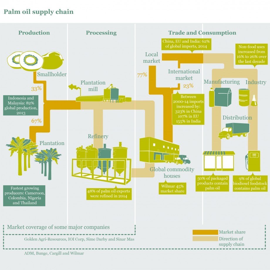
Palm oil is an ingredient in many U.S. food products, an important biofuel in Europe and is one of the world’s most widely-traded commodities. More than half the 70 million tons of palm oil produced annually is consumed in five regions — India, China, the European Union, Malaysia, and Indonesia. The last two are also the biggest producers of palm oil, and the Roundtable on Sustainable Palm Oil (RSPO) is calling on stakeholders to move to 100% certified sustainable palm oil with a particular interest in these biodiverse regions.
When sourced sustainably, palm oil benefits the world. Its high agricultural yield and low need for landmass make palm oil the most efficient vegetable oil in the world. Its versatility has extended food shelf life, made consumer goods more accessible, and has significant health benefits. The palm oil industry has also integrated almost 4.5 million Malaysian and Indonesian citizens into the global economy. When sourced unsustainably palm oil can inadvertently harm the environment, eroding its societal benefits. So how do you tell the two apart?
Welcome to the Asian problem that is also the world’s problem — palm oil sustainability. Orbital Insight is partnering with consumer goods giant Unilever to reimagine a technology-driven approach to track palm oil for a more sustainable future. This project shows how satellite imagery can be combined with AI and other data sources to provide unprecedented visibility into the physical world, protect the environment, and drive positive business outcomes.
Identifying The Problem
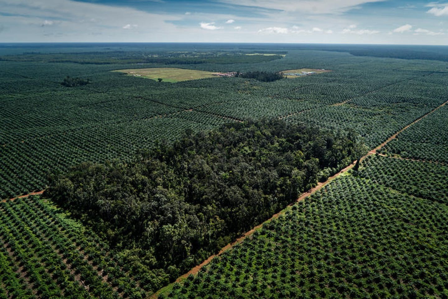
Despite its global appeal, unsustainable palm oil has been identified by the United Nations as a major culprit in environmental degradation and biodiversity loss. When rainforests in Malaysia and Indonesia are levelled for oil palm plantations, the habitats of tigers, elephants and other wildlife are destroyed along with it. Aborigine peoples living at the forest’s edge are also displaced, and the deforestation leads to higher greenhouse gas emissions globally.
That's why sustainability is such a critical issue for companies that use palm oil for everyday foods like chocolate and ice cream, and in cleansers like soap and detergent. Consumers are increasingly concerned about the upstream impact of the products they buy, and brands face intense pressure to mitigate these effects. But the global nature of modern supply chains makes this immensely challenging. Many brands have little visibility beyond their first tier of suppliers, and the paper-based record-keeping that is widespread in developing countries adds to the difficulty.

Towards Zero Net Deforestation
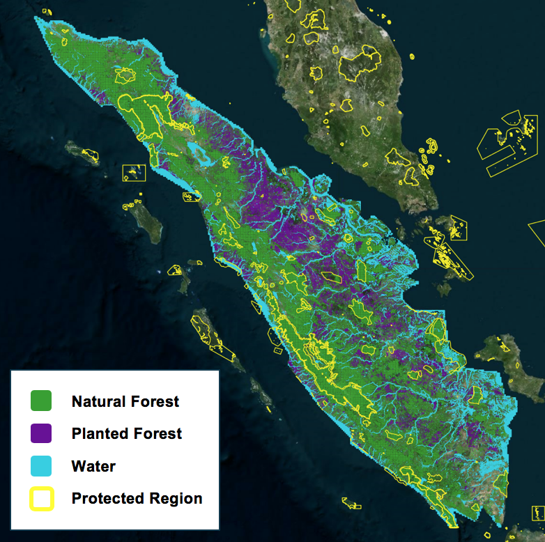
Unilever is the leader among major palm oil buyers that have committed to zero net deforestation and is working with its suppliers and partners globally to make that happen. Deforestation is a huge challenge that is only achievable through collaboration with businesses, farmers, and governments. To this end, Unilever is working with Orbital Insight to combine satellite imagery and IoT data sources to build a detailed, global map of palm oil production that provides granular visibility into Unilever’s supply chain, from the commodity it purchases back to the palm oil tree from which it originates. Through these and other efforts, Unilever is developing approaches to sustainable production that could benefit the entire industry.
How We Do It
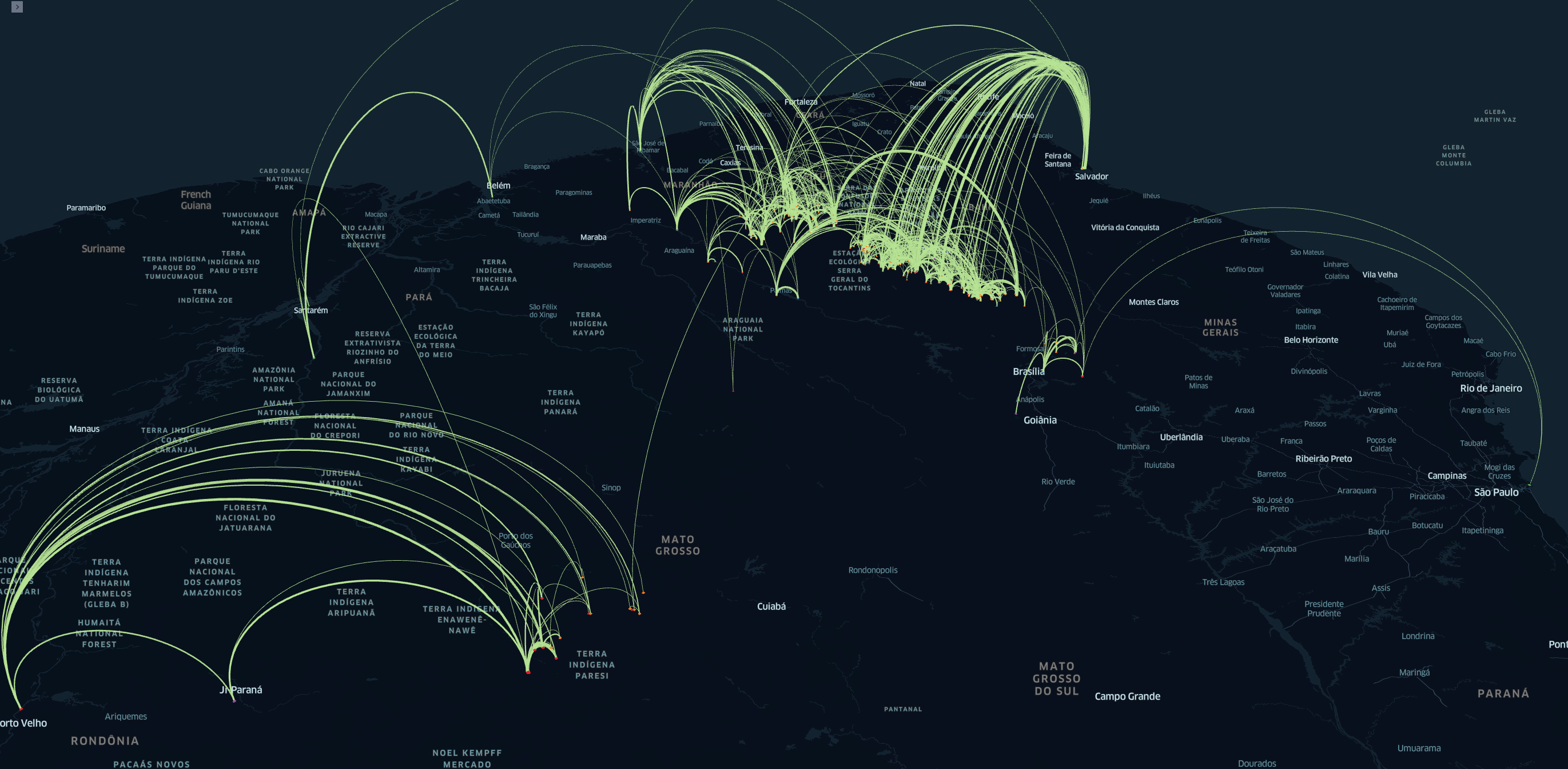
As part of our work with Unilever, we identified the producers supplying it with raw materials by examining the truck parking lots at known locations in its supply chain, such as a warehouse, refinery, port, mill or silo. From there, using anonymized device data to track the path of the trucks, we created a detailed map that extends back to the start of the supply chain.
By counting trucks on the trail, we can provide granular visibility into the frequency of deliveries and insight into what each farm is supplying. This way, Unilever can discover the farms, silos, refineries and other nodes in its supply chain and understand their significance and how they are using the land.
Analysis of satellite imagery allows us to identify any deforestation that has taken place historically or recently at these suppliers -- for example, if virgin rainforest was leveled for planting or to build roads, buildings and other infrastructure. Unilever can then incorporate this information into their digital ecosystem to identify the sourcing relationships and their historical and ongoing practices to ensure that their supply chain meets their sustainability objectives.
Beyond Palm Oil
While our work focused initially on palm oil supply chains for Unilever, we are now helping other consumer goods companies understand blind spots in their supply chains for other crops associated with deforestation. The good news is that our methodology can be applied to other products in various parts of the world, whether it’s soybeans in Brazil, rubber in Malaysia, or paper pulp in Thailand.
Our geospatial and AI-driven GO technology allows us to continuously monitor planted and natural forests, grasslands and agriculture, water resources, buildings and roads. We can quantify cars, trucks, ships, railcars and commercial aircraft. For deforestation in particular, we can monitor the density and movements of workers along with port activity to help our customers identify and reduce the harm happening on the ground.
Future Applications: New Commodities, Industries
From rainforest sustainability to the forest fires in North America and Australia, geospatial data is enabling a new mindset, helping brands, governments and NGOs to understand how they can leverage new data sources to solve problems.
In accordance with our strict data privacy policy, any geolocation data we collect is anonymized and aggregated. We also deliver identity-proof products such as heat maps or places of interest that are identified or ranked through geolocation.
In any industry, our goal is to understand our customers’ pain points, identify them early through the use of artificial intelligence and build customized, real-time solutions for problem monitoring so they can respond expeditiously. In this way, brands can move from worrying about their next PR crisis to taking action as Unilever has done, building market leadership and effecting positive change in the world.
Go deeper
- Get the Case Study: Download Unilever's approach to tackling deforestation using geolocation data
- Learn about more use cases for Supply Chain Traceability and Sustainability
- Explore Supply Chain Intelligence
- Download the eBook, 7 Keys to Your Supply Chain Success, and see how our customers, such as Unilever, Celanese, BP, and others, are using geospatial analytics to gain Supply Chain Intelligence
Recommended for You
-

whitePapers
Elongating Global Supply Chains | A Real-Time Lens Into An Escalating Global Problem
In the fourth piece in a supply chain series, the RBC Capital Markets Digital Intelligence Strategy Research team tracks 22 of the world’s largest and most influential ports using several layers of alternative data and geospatial intelligence, provided by Orbital Insight. Tracking the evolution of global port congestion, this report provides a real-time lens onto an escalating global problem. Included: World’s largest and most important ports ranked by efficiency metrics
Learn More
whitePapers
7 Keys to Your Supply Chain Success
According to McKinsey, all supply-chain operations areas benefit from digital technologies leading to 20-30% on time, in full improvement. As a supply chain leader, you need to leverage digital technologies to understand anomalies, outages, and disruptions at your suppliers and your supplier’s suppliers, and your competitors. And this needs to happen in near real-time to allow efficient and cost-effective business decisions. Post-pandemic visibility, traceability, and resiliency have become even more critical.
Learn More