


- Orbital Insight Blog
- Understanding the Impact of Hurricane Dorian Across Thousands of Locations
Blog
Understanding the Impact of Hurricane Dorian Across Thousands of Locations
For over a week now, we’ve seen evidence of Hurricane Dorian’s destruction, from the Caribbean to the United States. While the true death toll and extent of damages are unknown, Orbital Insight has been applying artificial intelligence to help humanitarian organizations and response teams understand the events leading up to the storm, its impact, and return back to the counties that were evacuated.
While eyewitness reports and photos provide a glimpse into the damage caused by Dorian, it is still difficult for responders to gain a comprehensive view across the expansive geographic areas that were affected. We applied AI to discover and analyze how the disaster impacted thousands of locations— entire counties, towns, cities, retail centers, factories, ports, and nuclear plants. This blog post will examine a few of these locations and industries:
The Bahamas
In our mission to understand what happens on and to the Earth, we first looked at the Bahamas where Dorian first hit and was responsible for the greatest toll in human life. By applying computer vision and machine learning to high-revisit 3–5 meter Planet imagery, we were able to identify the infrastructure damage at scale, with the granularity needed to identify specific houses and structures impacted by the hurricane.
This helps responders and non-profits triage which areas require urgent assistance. In the aftermath, insurance companies can use this data to quickly pay out claims so those impacted by the disaster can begin rebuilding their homes and their lives.
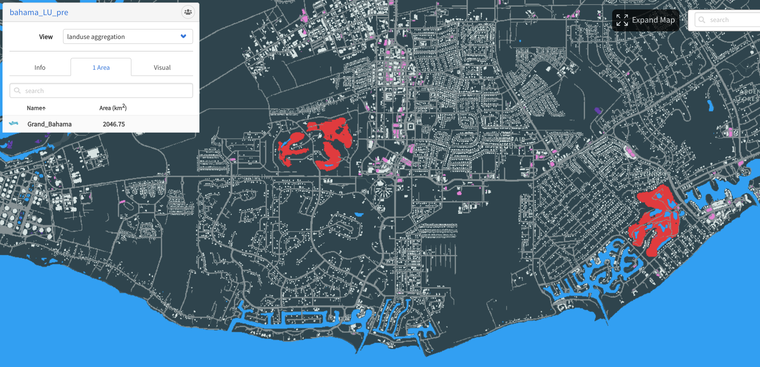
Prior to the storm, we used a computer vision algorithm to perform country-wide building detection across the entire Commonwealth of The Bahamas.
Building our algorithms on high revisit sources like Planet Doves — as opposed to infrequent sources or inconsistently dated wide area mosaics — allows us to reliably conduct analyses like these on a rolling basis, and/or around a bespoke trigger event (as is the case here), and guarantee that they are both timely and up-to-date.
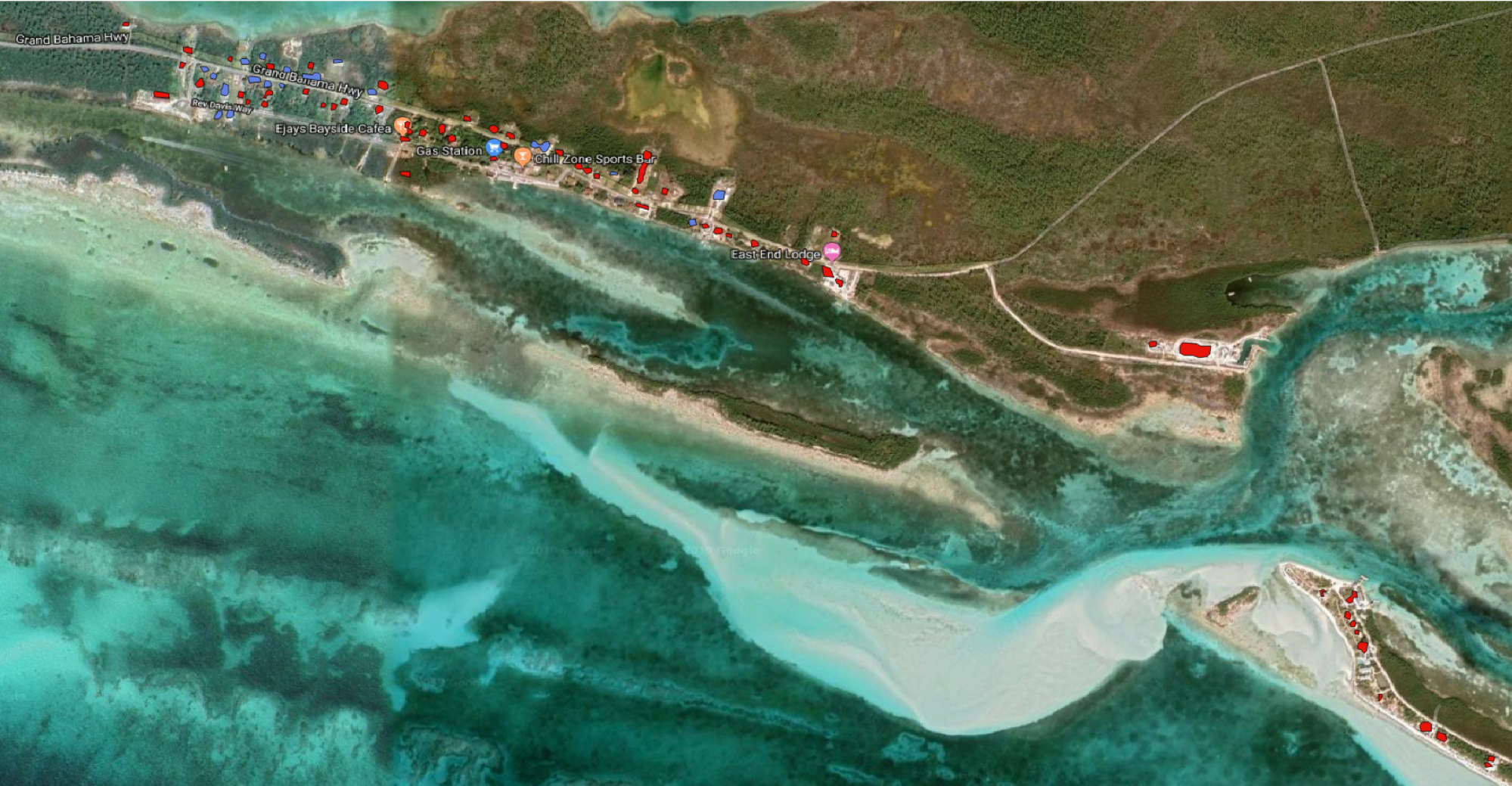
We’ve taken the pre-event imagery, scanned it for all the buildings that existed then, and then scanned those against the after imagery to see which ones are no longer visibly detectable on medium resolution imagery. The following two graphics show the results of this analysis in both central and more remote, more sparsely populated areas respectively; buildings no longer observed are marked red, while those that are still detectable on medium resolution imagery are marked blue.
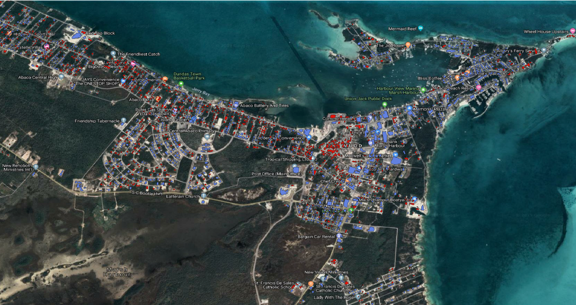
Orbital Insight identifies the individual structures destroyed (red) and those remaining (blue) in Marsh Harbour, The Bahamas.
In addition to revealing structural damage observed from satellite imagery, location-based intelligence can aid humanitarian assistance and disaster relief efforts by revealing the pattern of life — or human activity—before, during, and after crises. In Marsh Harbour, for example, Orbital Insight was able to detect a baseline pattern of activity and compare it to post-event activity — which dramatically declined on September 1, 2019 when Dorian made landfall.
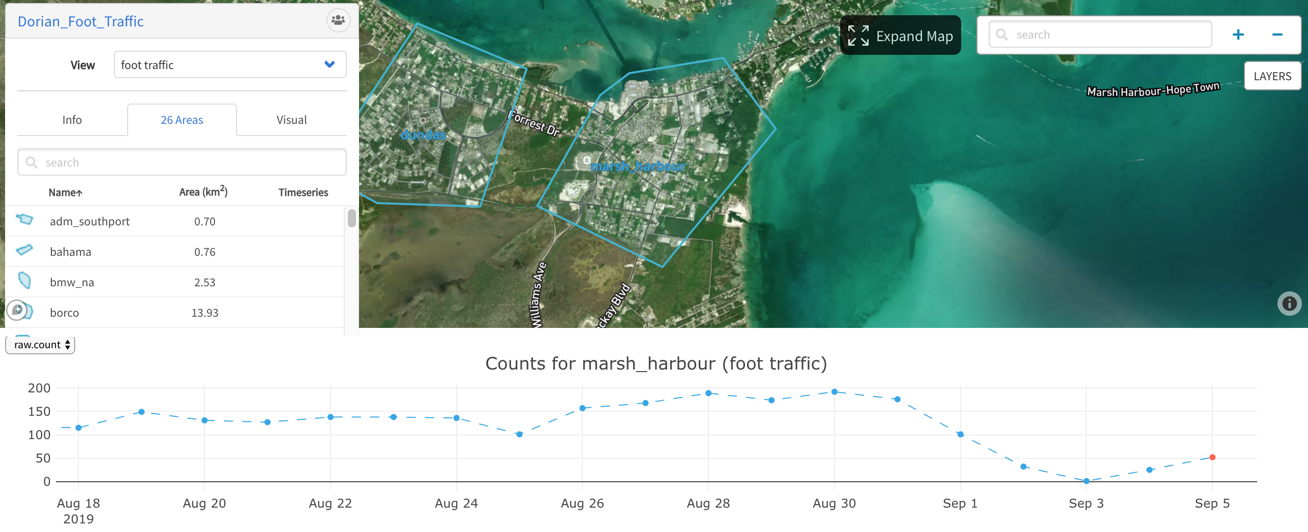
Marsh Harbour experiences a significant decline in foot traffic as Hurricane Dorian makes landfall on September 1.
Local Business Economic Resilience
Another facet of disaster response is the disruptions that occur across supply chains — whether these disruptions are caused by manmade or natural events. This is especially true in the Autos vertical, where businesses need to monitor major assembly plants in the disaster path. These plants experience shutdowns which result in lost profits and revenue — but also impact local businesses and economic resilience post-disaster.
Located in Dorchester County, South Carolina and situated in State Evacuation Zone D, The Volvo Ridgeville Campus, located in Dorchester County, South Carolina experienced a full week of plant closures. The entire state coastline received mandatory evacuation notices and as a result, Volvo’s plant experienced unplanned downtime for the entire workweek.
Geospatial analytic assessment prior to disaster events can help companies like Volvo estimate the number of days their employees will be out of work and prepare outreach and support for employee evacuation. This can also be used to begin strategizing economic recovery plans for both the local plant and the company as a whole.

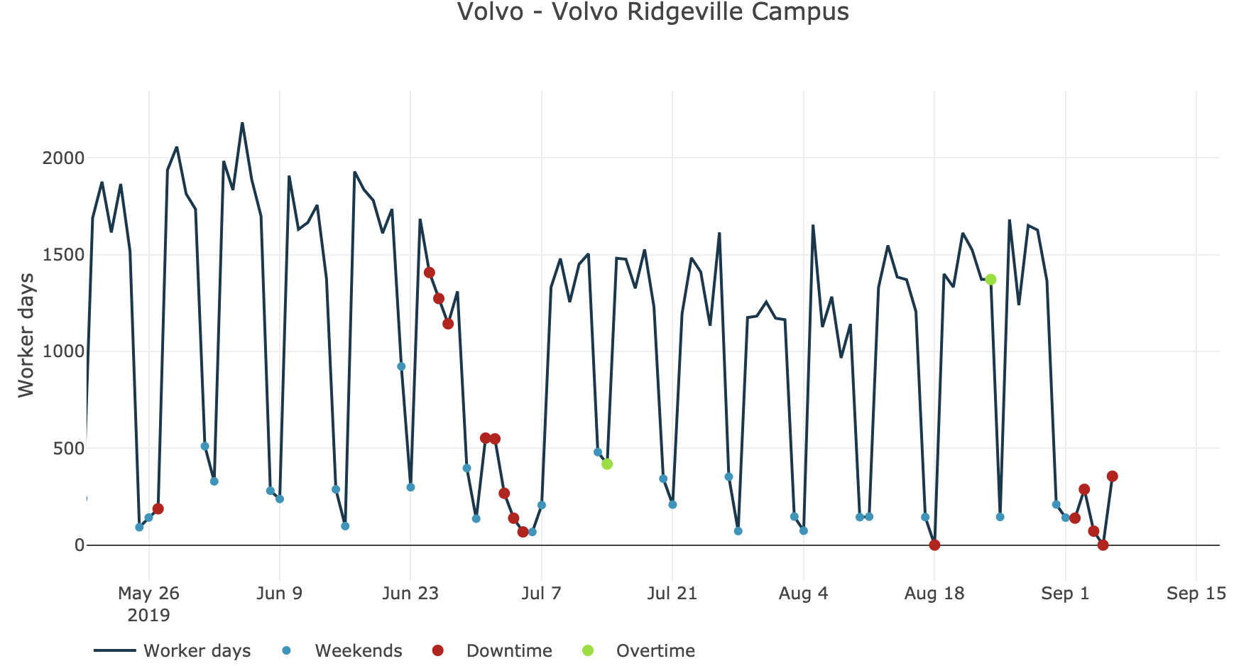
(Left: South Carolina State Evacuation Zone Map; Dorchester County located in Zone D. Right: Workforce trends at Volvo Ridgeville Campus dramatically decline as a result of the mandatory evacuation).
Port activity is another metric to carefully monitor for economic and business resilience. One area we monitored was BMW of North America’s port operations in Brunswick, Georgia where operations stopped as early as August 31, resuming September 5.
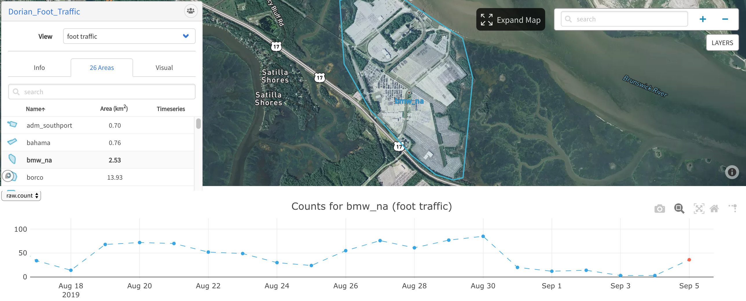
BMW North America’s Port Operations are suspended during Hurricane Dorian and resume September 5.
Energy & Environmental Concerns
Many natural disaster events result in a massive loss of power to surrounding residents / businesses and sometimes widespread environmental damage.
In Florida’s Turkey Point Nuclear Power Plant, we actually observed an increase in traffic, likely to ensure that operations were running smoothly to maintain power and prevent environmental damage.
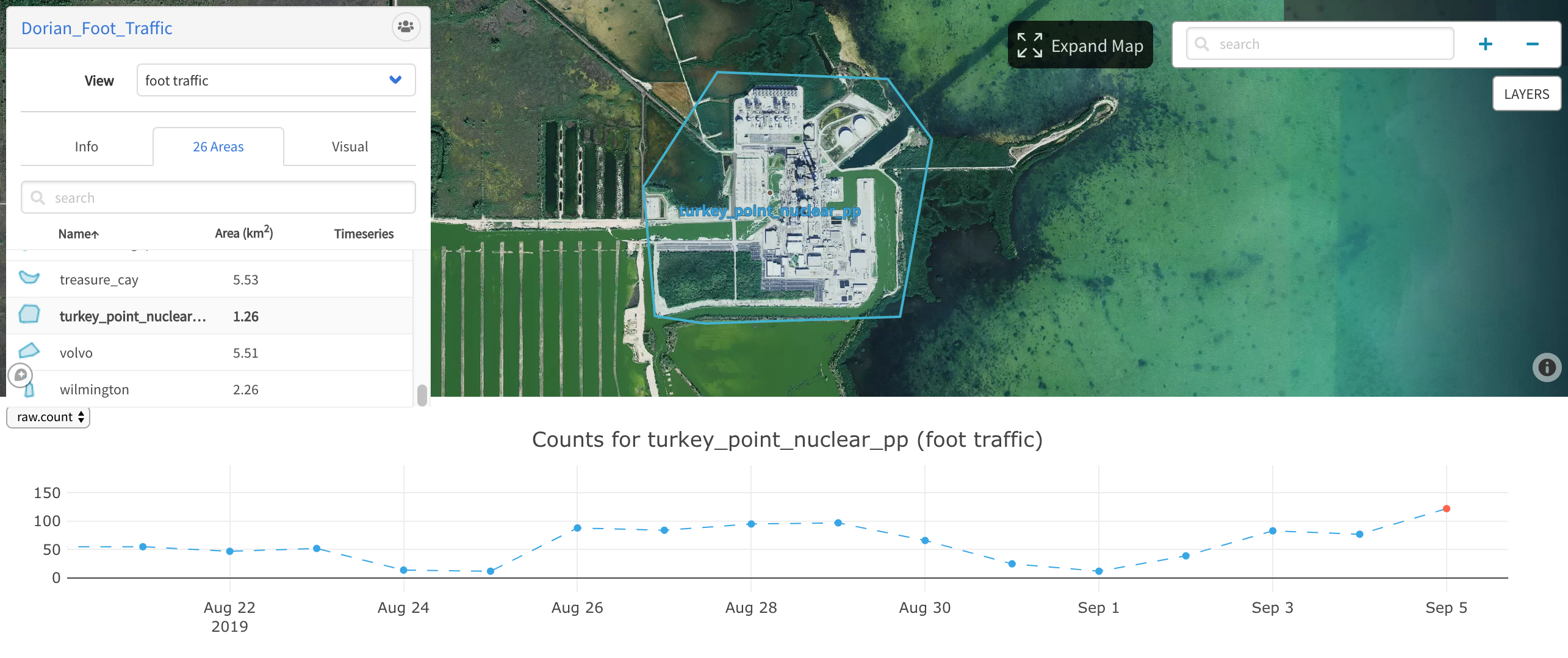
Turkey Point Nuclear power plant remains active and even sees an increased workforce following the hurricane.
A similar trend was observed at Lucie Nuclear Power Plant (below).
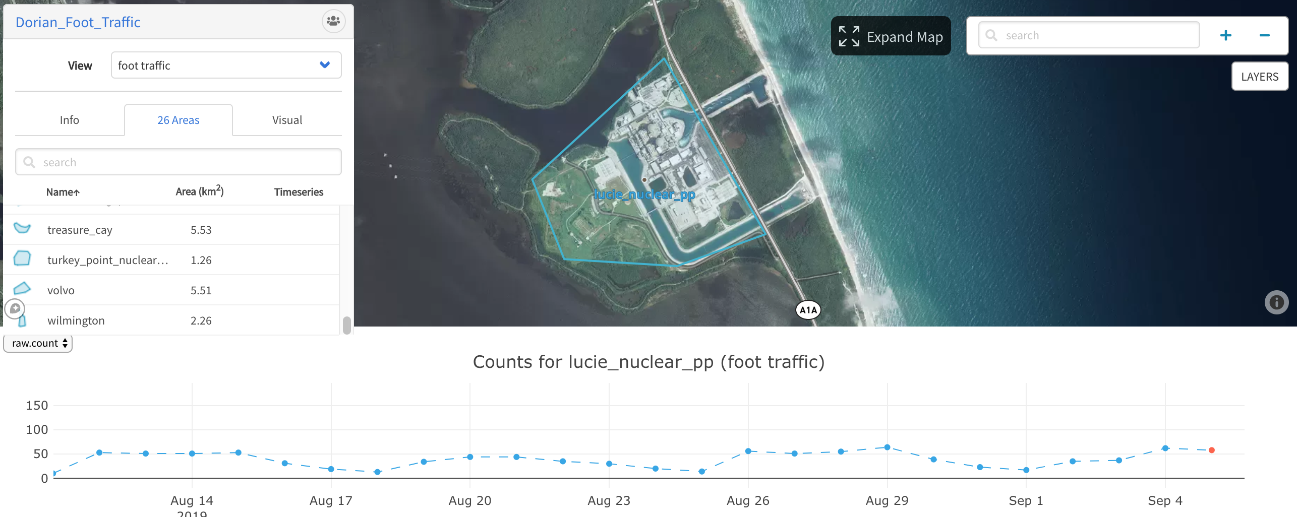
Lucie nuclear power plant remains active as Orbital Insight observes a normal pattern of workforce.
Pre and Post Disaster Civilian Support
Automated geospatial analytics allow Local Governments to track the exodus, impact, and return of civilian populations across wide areas of interest. These data facilitate disaster preparedness, triage, response, and aftermath planning — all of which are critical to human safety. To accurately conduct these analyses, we have applied data science algorithms that transform raw data from millions of connected devices into actionable information.
At Hilton Head, South Carolina Orbital saw evacuations as early as September 1 and a small return on September 5 with population levels increasing each consecutive day in a hopeful return to pre-event levels.
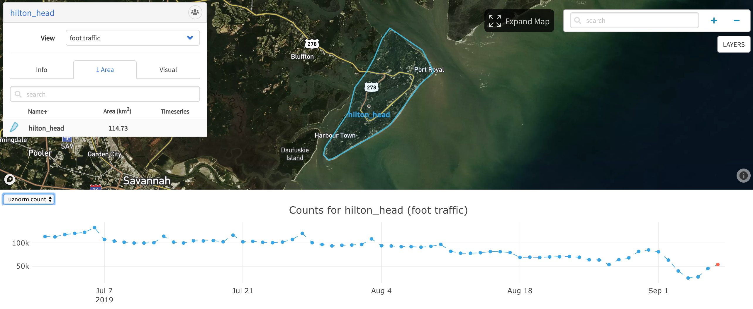
Hilton Head begins evacuating on September 1 and returns begin as early as September 6.
In Charleston, South Carolina, the first major exodus took place on September 2nd with the city at its lowest population level on September 5th. The next day, Orbital Insight observed a significant return to the city and subsequent population growth the next day.
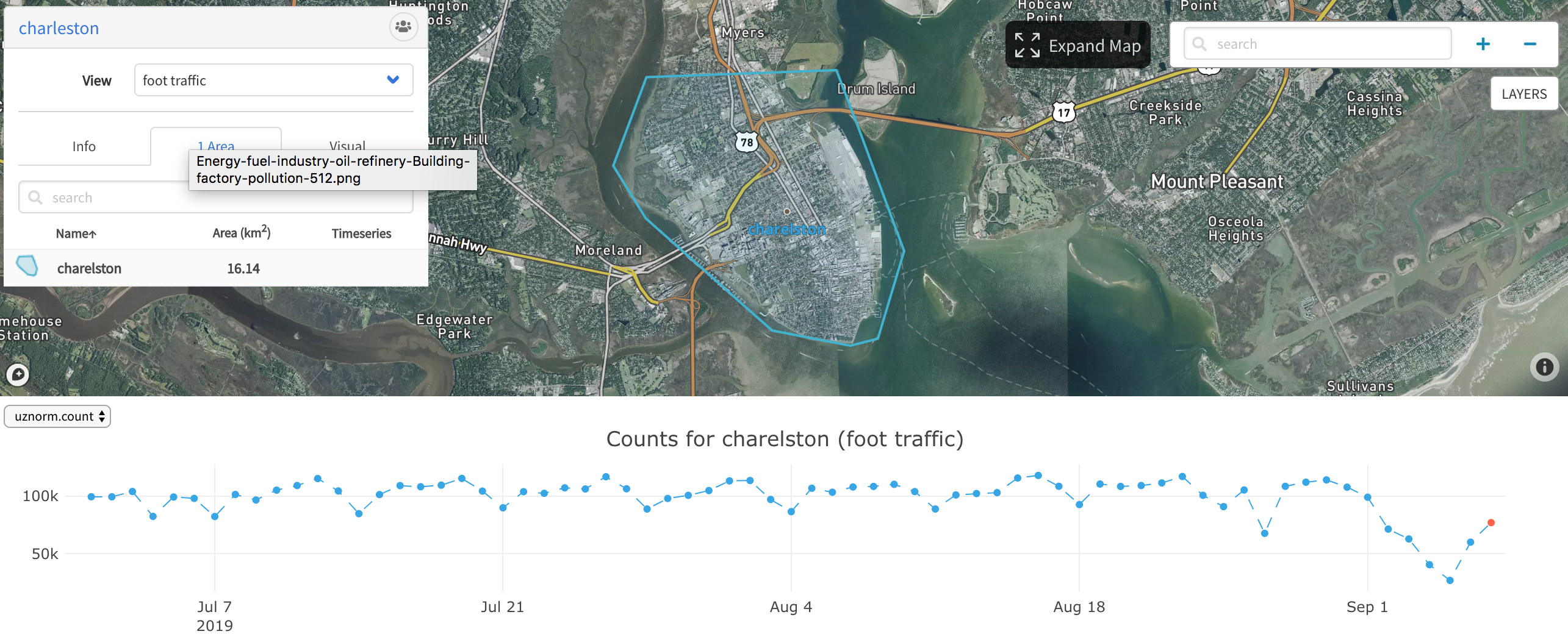
Hilton Head begins evacuating on September 1 and returns begin as early as September 6.
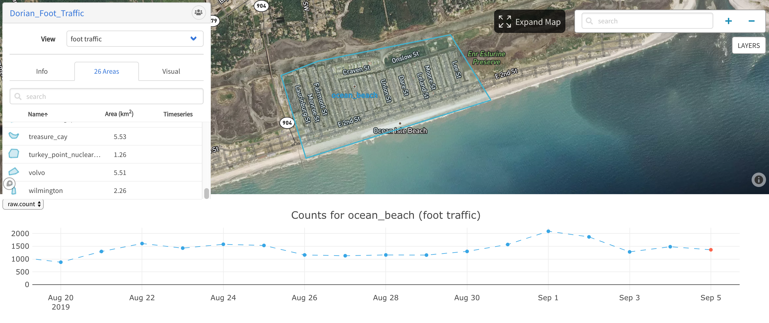
Orbital Insight did not observe a significant decrease in population at Ocean Beach, South Carolina.
Conclusion
As extreme weather events, unfortunately, become more frequent and destructive, geospatial analytics can help first responders, insurers, asset owners, other stakeholders understand what is happening at unprecedented speed so that they can support those impacted by disaster events.
Orbital Insight will continue to leverage our AI-empowered Geospatial Analytics Platform to understand what is happening on and to our Earth and support those in need.
Out recently launched platform, Orbital Insight GO, is versatile and designed to answer your specific question at scale—whether you’re interested in a large geographical area, or thousands of individual locations.
If you’re interested in gaining additional transparency for economic, humanitarian, and environmental policymaking, please reach out to us at info@orbitalinsight.com.
Recommended for You
-


Sep 18, 2019
Using GO to Observe the Operational Status of Suspected Chinese “re-education” Camps
Learn More -


-

Dec 19, 2018
Artificial Intelligence Helps Distinguish the Forests from the Trees (Part 2)
Learn More
Dec 11, 2018
Artificial Intelligence Helps Distinguish the Forests From the Trees (Part I)
Learn More