


- Defense, Intelligence & Law Enforcement
geospatial solutions
Defense, Intelligence & Law Enforcement
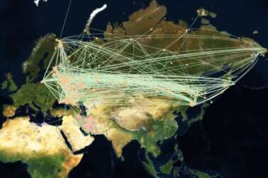
A new way to analyze situations, detect anomalies, and visualize dynamic threats -- globally.
Beyond Geospatial
Orbital Insight serves the US government, military, and law enforcement communities with data science services that leverage deep understanding of geospatial information and an array of geolocation sources.
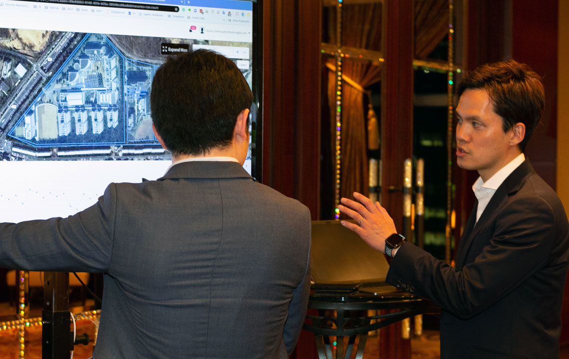
We are reshaping how the public sector uses Artificial Intelligence, Machine Learning, and geospatial analytics with approaches like GO.
Simply put, we’re helping Government discern the “what, where, and when" to support and protect constituents.
"I wish I would have had access to GO while I was working at DIA. Identifying warnings of events that impact national security is a 'minutes game'."
...attempting to generate this trend data without the aid of Orbital Insight's computer vision algorithms would take individual analysts weeks or months versus Orbital Insight's hours or days.
Use Cases
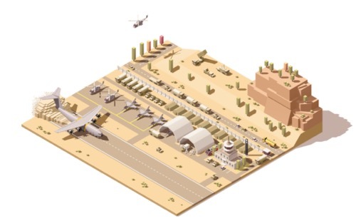
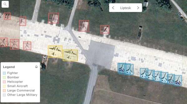
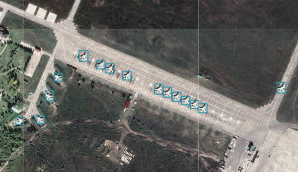
Target Detection
Track time series for military assets and monitor alerts with object counts of aircraft, ground equipment, and ships at military bases and ports.
Wide Area Activity Monitoring
Monitor activity over large regions (e.g. borders and rural areas) using traditional and next-gen high altitude sensors.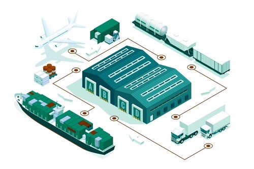
Supply Chain Traceability
Discover, map, and monitor the multi-tier relationships that make up the supply chain networks that you and—your peer competitors—rely on. Uncover the logistical links between factories, suppliers, and distribution facilities on a global scale.Showcases
Object Detection
Analysts can automate detection and analysis of activity-based data. We combine electro-optical satellite imagery with advanced algorithms to detect and flag objects with high precision including cars, trucks, ships, and multi-class aircraft.
Geolocation
Analysts can layer and fuse foot traffic, IoT, demographic, and signals data for greater contextualization. We pull from billions of daily anonymized and aggregated geolocation “pings” to provide the right data for today’s snapshot or trends over time.
Example: Hourly heatmap of foot traffic at US Capital, Jan 6, 2021

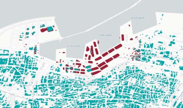
Land Use
Analysts can use GO to identify multiple classes of land use on a national or global scale and quickly perform infrastructure updates and foundation mapping.
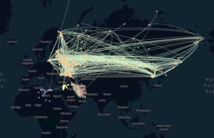
Traceability
Analysts can see connections among locations and track movement between locations over time.
Capabilities
What gaps do you need to bridge?
Our data services can help you bridge many:
- Share results easily with mission partners through unclassified results
- Discover insights that may go unnoticed using more traditional data sources
- Visualize data and geolocate it, so others can “see” your analysis
What can we automate for you?
Our data services don't replace analysts—we free up time to focus on the analytical tasks humans do best.
- Tip-and-cue your analysts to what matters most
- Automatically monitor a multitude of AOIs—local to global
- Reduce the time from event to analysis and decision
What can you monitor at scale?
We bring a world of data to you — from satellite sources with high revisit rates to billions of geolocation data — so you can monitor human activity around the globe.
What does it take to get started?
We won’t lie - this level of sophisticated data analytics isn’t as easy as pie. But we’re here to make it feel that way.
- We can provide you GO and cut you loose on the data with minimal training. See the User Guide.
- Work directly with our team to conquer your more complicated analytic challenges.
You choose the approach that works best for you.
Our services are available today on the cloud, making access easy. And, we’re adding new algorithms and sources to constantly improve our services.
Learn more about how government organizations are using OI data services at our blog.
GO Success Story for Geospatial Intelligence
Challenge: Quantifying foreign military disposition of aircraft at scale is costly and time consuming.
Solution: Automate multi-class aircraft detection at scale and run on all available imagery.
Results: In one demonstration, GO counted 53,974 aircraft from 2,469 scenes and 342 areas of interest in only one day. It takes a trained analyst about 7.5 days to do the same.

Benefits
Speed of Analysis
Automate data creation and scan trends at a fraction of the time.
Scalable Intelligence
Assess trends and actions across countries and regions.
Identify Indications and Warnings
Empower the warfighter to save lives and keep the peace.
Robust Monitoring
Predict and prevent threats by analyzing human activity.
Related Resources
-


blog
Sep 18, 2019
Using GO to Observe the Operational Status of Suspected Chinese “re-education” Camps
Learn More -

blog
Aug 19, 2019
Battle of Marawi: Using Object Detection to Observe Trends Before, During, and After Urban Combat
Learn More
How can we help you?
Drive better business and policy decisions by contacting us today.
Contact Us
Fields containing * are required.