


- Orbital Insight Blog
- Using Mobile Phone Geolocation Data to Understand Lower-Income Areas in Cairo
Blog
Using Mobile Phone Geolocation Data to Understand Lower-Income Areas in Cairo
 At Orbital Insight, our mission is to understand what is happening on and to the Earth. We’ve long focused on monitoring change in the built world, for example, building destruction in the Bahamas following Hurricane Dorian or the expansion of industrial-scale oil palm plantations contributing to deforestation in Southeast Asia. Leveraging mobile phone geolocation technologies, we’ve added another layer, empowering developers and local government to better understand the movement, commuting, and shopping patterns of populations in the United States and beyond.
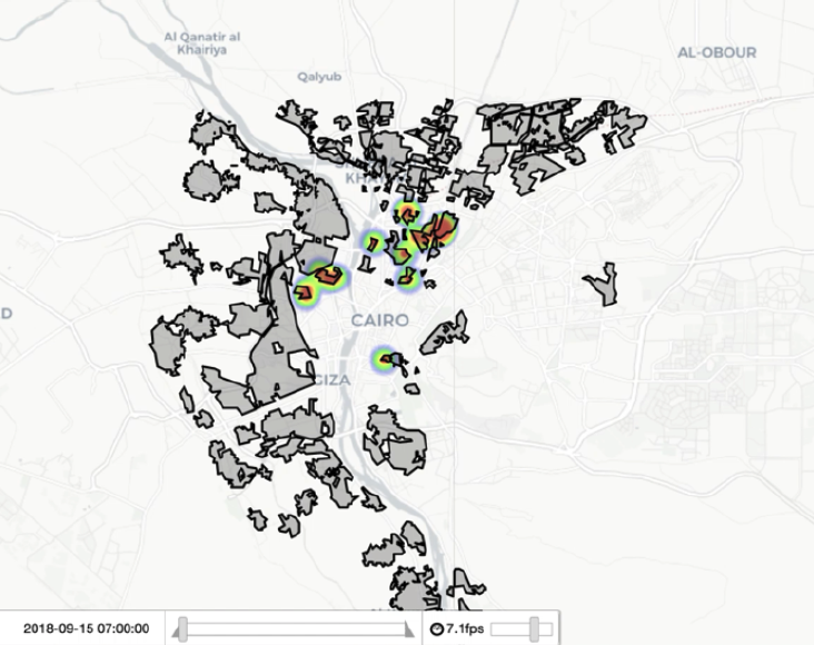
Now, in partnership with the Arab Human Development Report team at the United Nations Development Programme (UNDP), we turn this same geolocation toolkit to UNDP’s mission of eradicating poverty and reducing inequalities in the developing world, in our case focusing on the slum dwellers of Cairo, Egypt. As in many nations, Egypt’s economic growth has not widely translated into additional services for the urban poor, further exacerbating inequality for many of the region’s 20.5 million residents. Data scarcity, limitations of traditional surveying and the sheer scope of the challenge leave development organizations and governments searching for new approaches.
Together, our objective was to explore anonymized and aggregated location data sourced from smartphones as a way to ask and answer new questions. By combining Orbital Insight geolocation data and UNDP-provided slum boundaries, we were able to dig into several questions about the aggregated behavior of devices, and by extension, the population living within the slum boundaries. Please see the attached paper for our initial conclusions on:
- The ratio of people to devices in slum areas vs. non-slum areas, and implications for mapping poverty
- Average commuting distance for slum dwellers vs. non-slum populations
- The demographic composition of visitors to public and private universities
- Limitations to the geolocation dataset in an international development context, the impact of such limitations on the partnership’s research goals, and strategies to mitigate these challenges in the future
To download the report, click HERE.
Orbital Insight’s mission is to help the world understand what is happening on and to the Earth. Through multiple sources of geospatial and proprietary AI, we deliver a 360-degree view into the physical world at the speed of change in an approachable and versatile platform designed to answer your specific questions.
To ask your first question with Orbital Insight GO, email info@orbitalinsight.com.
Recommended for You
-


-


Oct 22, 2018
Using Geolocation Data to Understand Consumer Behavior During Severe Weather Events
Learn More